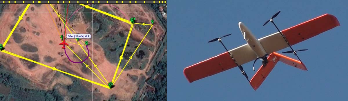
In June 2016, there was continuous rain for weeks and one mountain got weakened its sides where people had well-established farming going on. With the mudslide that took place at night, more than 100 people lost their lives. Our team was there to map the extent of the damage. Ceymapper drone was deployed over the area of the landslide. As the drone climbed over the mountain while capturing the photos, at about 650m, it wasn’t able to cope with the strong headwind. 1st times, it wasnt moving relative to the earth. So, the mission was aborted with the parachute deployed, and the drone landed half-way on the mountain. The drone was recovered while landing on a tree, undamaged. Photos were there to create a map of about half of the extent of the landslide.
Landslide mapping in 2016